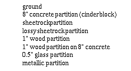
Walls are either vertical (true walls and partitions) or horizontal (ceilings and floors). The wall coordinate data may be generated manually or electronically. To create these files manually, two opposite corners of every plane in a building must be identified and entered into a text file, which is impractical for most buildings. Alternatively, these files may be created via a Computer Aided Design (CAD) system.
The overall CAD process is as follows. First, the floor plan must find its way into the CAD package. This is done by scanning a floor plan drawing or obtaining an existing electronic version. If an electronic version is available, the recommended file format is Drawing Interchange Format (DXF), a standard ASCII file that represents drawing entities as vectors. If only a paper drawing exists, the floor plan must be scanned and saved to a raster file (e.g., TIFF, PCX, etc.). Commercial software can then be used to convert the raster file into a vector format or display the raster image directly in the CAD environment.
With the drawing displayed on the CAD screen, the relevant building features are traced over the original drawing. Using the CAD layering capabilities, the original drawing and subsequent traced features are kept on different layers. Also, walls with different constructions are kept in separate layers. Once the 2-d drawing is complete, each layer is independently extruded in the third dimension to give it height. Adding a ceiling and floor completes the three-dimensional drawing.
The resultant CAD drawing can now be exported back to DXF and filtered through the DXF2WISE conversion program. DXF2WISE extracts the relevant building coordinate data and ensures that these walls are valid for WiSE. A valid wall must be rectangular, horizontal or vertical, and not a repeat of or enclosed by another wall. Invalid walls are simply ignored. The output of DXF2WISE is the finished building database for the WiSE propagation model.
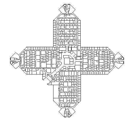
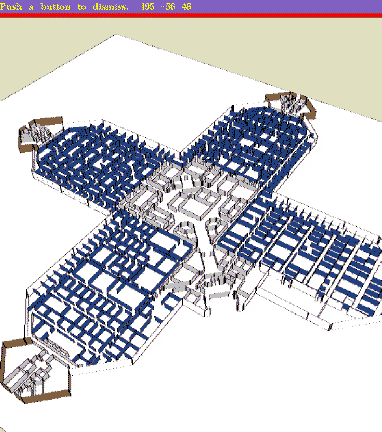
These techniques have been used to create databases for more than a dozen buildings, ranging from one floor of Bell Labs at Crawford Hill to the New York Stock Exchange and the Hynes Convention Center in Boston. The starting point for these buildings covered the entire range from hand drawn sketches, through paper blue prints, up to CAD data files. Figure 1 shows a plan view of the AT&T facility at Middletown, NJ, one of our test cases, modeled with 1360 walls; Figure 2 shows the perspective view. For comparison, the NYSE has 1507 walls.